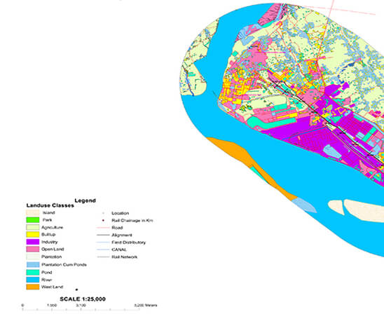
GIS, which stands for Geographic Information System, is a spatial data management system with its associated features. The system stores data on various objects in the space, and enables reviewing, analysis or data updating, if possible. The system enables the visualization of objects in the space on the appropriate cartographic substrates.
We in ORPAX recognized the importance of GIS mapping, as this advanced system found its application in numerous fields of industry and science.
Namely, the increased requirements regarding information management and database linking of various geographic locations has created an enhanced necessity for GIS mapping. As more and more organizations venture into this novel technology system, there are many benefits of a vastly improved management of organization resources.
GIS has the capability of linking data sets in order of geographical locations and, therefore, the system facilitates the sharing of inter-department communication and information which in turn leads to better productivity.
GIS mapping is among the first steps in this process. It is a procedure of collecting data about objects in the space, which necessarily involves recording the geographical position of the object (x and y coordinates).
This is why GIS mapping is a very important aspect of GIS that we at ORPAX invest in. Today, we have the resources required to provide a fully automated service for all types of projects that require modern GIS analysis and software tools. Technology on its own has no great value if you don’t have skilled and knowledgeable human resources to put it into practical use, manage and develop it. At ORPAX, we are not only dedicated to GIS mapping, but to people who can apply these solutions to real-world situations. Our dedicated and highly competent team of experts has achieved breakthrough innovations in implementing GIS mapping with aim of integrating spatial data and other data resources and preparing for the phase of GIS digitization.
Benefits of GIS mapping
We aim to become the global service provider of top-notch GIS mapping services. Towards realizing this goal, we have compiled a world-class solution range for those companies requiring the services of spatial information in the mapped and interpreted format. There are many benefits of GIS-based mapping. It is more user-friendly and flexible than the conventional cartography process. Retrieving GIS maps, reviewing and updating them saves months of hard work and time! GIS mapping is also one of the prerequisites and segments of GIS digitization, practices that enable endless possibilities in hundreds of areas of application.
In addition, for a large number of geographic-based operations, the final result is best visualized in a map format. In addition, GIS maps are storage efficient, have higher detail of representation and provide clear communication of geographic data. Our team of GIS mapping professionals has put together new and exciting applications and tools aimed at extending the conventional art and science elements of cartography. We provide GIS mapping services such as map displays included in reports, photographic images, 3D views, multimedia outputs, etc.
Our unique GIS mapping practices and solutions have been appreciated and used by many organizations for data management and presentation because of the flexibility and customized presentation techniques we have integrated into each service output. We have created diverse GIS mapping services to suit a variety of client requirements.
Our GIS mapping services include:
- Custom mapping
- Shoreline mapping
- Utility mapping
- Parcel mapping
- Municipal mapping
- Wildlife and habitat monitoring
- Reclamation activity mapping
